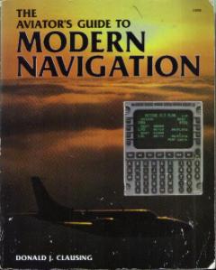
THE
AVIATOR'S GUIDE TO
MODERN
NAVIGATION
- Softcover Book by Donald J. Clausing
- Over 245 pages
- FIRST EDITION; FIFTH PRINTING
- © 1987 by TAB Books
Contents include:
" Acknowledgments
Introduction
1 Pilotage and Dead Reckoning
Principles of Dead Reckoning
VFR Applications
IFR Applications
Dead Reckoning in Remote Areas and Over Water
Emergency Instrument Navigation
Advanced Applications
Conclusion
2 VOR Navigation Fundamentals
Principles of Operation
Identification
Orientation
Drift
Wind Correction
Tracking
Positioning
Testing
Limitations
3 Distance Measuring Equipment
Co-location of VOR and DME
VOR/DME, VORTAC, and TACAN
Principles of Operation
Accuracy
General Operation
Derivative Information
Identification
Capacity
Slant Range Error
DME Arcs
Rho-Rho Navigation
Summary
4 VOR/DME Navigation
VFR VOR Navigation
The Victor Airway System
Victor Airway Routes
Victor Airway Characteristics
Flying the Victor Airways
Airway Navigation-Inbound
Magnetic Alignment
Non-Standard Change-over Points
Intersections
Receptions Altitudes
Jet Routes
Dual VOR Techniques
Radio Magnetic Indicators
Conclusion
5 VOR/DME Based RNAV
Theory of Operation
VFR Applications
IFR Applications
Limitations
Outlook for VOR/DME-Based RNAV
6 NDB Navigation
Principles of Operation
ADF Operation
NDB Types and Locations
ADF Indicators
Homing
Tracking
Positioning
Limitations
Accuracy
Conclusion
7 Ground-Based Radar Navigation
The Role of Radar in Air Navigation
Radar Principles
Secondary Versus Primary Radar
Traffic Advisories
Vectors
Resuming Normal Navigation
Positioning
Groundspeed Determination
Surveillance
Conclusion
8 Instrument Approaches
Elements Common to All Instrument Approaches
VOR and NDB Approaches
ILS Approaches
Localizer Approaches
LDA and SDF Approaches
Circling Approaches
Microwave Landing Systems
LORAN-C Approaches
Satellite Approaches
9 LORAN-C Navigation
Long Range Navigation
LORAN-C Theory of Operation
Areas of Coverage
Control-Display Units
Initialization
VFR LORAN-C Navigation
IFR Applications for LORAN-C
Limitations
Accuracy
Growth Prospects
10 OMEGA/VLF Navigation
OMEGA and VLF
General Theory of Operation
Operating Modes
Control-Display Units
Initialization
Rate Aiding
Propagation Anomalies
OMEGA/VLF Accuracy
The Role of OMEGA/VLF
Future Prospects
11 Inertial Navigation Systems
General Description
Inertial Reference Systems
Control-Display Units
Initialization
En Route Data
Drift
Updating
Dual Installations
Triple Installations
Triple Mixing Versus OMEGA Updating
INS and General Aviation
12 Satellite Navigation
General System Description
Theory of Operation
Derivative Information
Prototype User Systems
Integration with LORAN-C and INS
Additional Capabilities
Time Table for Completion
The Diminishing Role of the VOR
The Long Term Outlook for General Aviation
13 Over-Water Navigation
General Characteristics
Navigational Requirements
Flight Planning
Fuel Planning
Equal Time Point
Point-of-No-Return
Single Engine Range
Unpressurized Range
ICA Flight Plan
En Route Procedures
Conclusion
14 Navigation in Non-Radar Environments
Background
Non-Radar Areas
Position Reporting
The Position Report
Estimating Times
Position Verification
Uncontrolled Airspace
Transitions
Summary
15 Radar Terrain Mapping
Radar Terrain Mapping Characteristics
Normal Uses
Emergency Uses
Conclusion
16 Electronic Flight Information Systems
General Descriptions
The Electronic Attitude Director Indicator
The Electronic Horizontal Situation Indicator
The Multifunction Display
EADI/EHSI Back-Up
Reversionary Modes
The Long Term Prospects for General Aviation
17 Navigation and Flight Management Systems
Navigation Management- The Problem
Navigation Management- The Solution
Navigation Management Methods
Flight Management Systems
Satellite Navigation and NAV Management
Final Conclusion
Appendix A Document Sources
Appendix B Aeronautical Chart Sources
Appendix C Navigation Symbols
Appendix D Abbreviations
Glossary
Index "
This book is in good condition, but has moderate wear to the cover.
There are a few dirt marks on the side edges of the pages, mostly visible from the side view.
No torn or ripped pages.
There are a few pages with folded corners.
No other markings or writing except a price stamped on the first page.
|